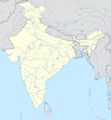
Dosya:India location map.svg

Bu SVG dosyasının PNG önizlemesinin boyutu: 557 × 600 piksel. Diğer çözünürlükler: 223 × 240 piksel | 446 × 480 piksel | 713 × 768 piksel | 951 × 1.024 piksel | 1.902 × 2.048 piksel | 1.500 × 1.615 piksel.
Tam çözünürlük (SVG dosyası, sözde 1.500 × 1.615 piksel, dosya boyutu: 1,23 MB)
Dosya geçmişi
Dosyanın herhangi bir zamandaki hâli için ilgili tarih/saat kısmına tıklayın.
| Tarih/Saat | Küçük resim | Boyutlar | Kullanıcı | Yorum | |
|---|---|---|---|---|---|
| güncel | 09.24, 4 Nisan 2021 |  | 1.500 × 1.615 (1,23 MB) | TKsdik8900 | Fulfilling the edit request (File talk:India location map.svg#Upload more compact version of India location map) by C1MM |
| 16.50, 14 Ekim 2020 |  | 1.500 × 1.615 (1,64 MB) | NordNordWest | correct Telangana/Andhra Pradesh | |
| 23.10, 3 Kasım 2019 |  | 1.500 × 1.615 (1,62 MB) | RaviC | slight colour change for consistency | |
| 23.06, 3 Kasım 2019 |  | 1.500 × 1.615 (1,62 MB) | RaviC | == {{int:filedesc}} == {{Information |Description={{en|Location map of India. Equirectangular projection. Strechted by 106.0%. Geographic limits of the map: * N: 37.5° N * S: 5.0° N * W: 67.0° E * E: 99.0° E Made with Natural Earth. Free vector and raster map data @ naturalearthdata.com.}} |Source={{own}} |Date=2010-02-20 |Author={{user at project|Uwe Dedering|wikipedia|de}} |Permission= |other_versions={{DerivativeVersions|India location map2.svg|India location map 3.png}} {{Other versions/I... | |
| 21.42, 19 Ağustos 2014 |  | 1.500 × 1.615 (1,59 MB) | M0tty | Update by Sémhur : add the state of Telangana | |
| 11.51, 7 Haziran 2011 |  | 1.500 × 1.615 (1,49 MB) | NordNordWest | Nagaland corrected | |
| 16.10, 18 Ocak 2011 |  | 1.500 × 1.615 (2,36 MB) | Uwe Dedering | Reverted to version as of 15:50, 17 January 2011 and again, layer structure destroyed, and first discuss this! | |
| 19.04, 17 Ocak 2011 |  | 1.500 × 1.615 (1,52 MB) | AshwiniKalantri | The disputed land of Kashmir are shown in a different shade. | |
| 15.50, 17 Ocak 2011 |  | 1.500 × 1.615 (2,36 MB) | Uwe Dedering | Reverted to version as of 11:34, 22 September 2010 vandalism | |
| 23.30, 16 Ocak 2011 |  | 1.500 × 1.615 (2,01 MB) | AshwiniKalantri | {{Information |Description=Location Map of India |Source= |Date= |Author= |Permission= |other_versions= }} |
Dosya kullanımı
Bu görüntü dosyasına bağlantısı olan sayfalar:
- 1905 Kangra depremi
- 2014 Orissa sarılık salgını
- 2017 FIFA 17 Yaş Altı Dünya Kupası
- Agartala
- Ahmedabad
- Aizawl
- Ajmer
- Ambala
- Apsarasas Kangri
- Bangalore
- Bareilly
- Begusarai
- Bharuch
- Bhubaneswar
- Bongaigaon
- Burhanpur
- Cemmu
- Cemşidpur
- Chennai
- Chittorgarh
- Daman ilçesi, Hindistan
- Darbhanga
- Dhubri
- Dibrugarh
- Dimapur
- Dispur
- Eluru
- Faizabad (Hindistan)
- Faridabad
- Gandhinagar
- Gurgaon
- Güney Asya Oyunları
- Haydarabad, Hindistan
- Homkund
- Imphal
- Indian Super League
- Indore
- Itanagar
- Jalandhar
- Jamnagar
- Jaynagar Majilpur
- Jind
- Jodhpur
- Kaithal
- Khammam
- Kohima
- Koçi
- Laccadive Denizi
- Malappuram
- Manasarovar Gölü
- Mangalore
- Mumbai
- Munger
- Nagpur
- Nathu La
- Navi Mumbai
- Nellore
- Noida
- Panaji
- Pangong Gölü
- Port Blair
- Puduçeri
- Pune
- Ranchi
- Rohtak
- Saharanpur
- Saharsa
- Shillong
- Shimla
- Siliguri
- Silvassa
- Solan
- Srikakulam
- Surajpur
- Teram Kangri
- Warangal
- Yamdrok Gölü
- Yamunanagar
- Yeni Delhi
- Çerapunçi
- İndira Gandi Uluslararası Havalimanı
- Şahcihanpur
- Modül:Konum haritası/veri/Hindistan
- Modül:Konum haritası/veri/Hindistan/belge
Küresel dosya kullanımı
Aşağıdaki diğer vikiler bu dosyayı kullanır:
- ace.wiki.x.io üzerinde kullanımı
- af.wiki.x.io üzerinde kullanımı
- Leh
- Taj Mahal
- Amritsar
- Sjabloon:Liggingkaart Indië
- Indore
- Thane
- Bhopal
- Visakhapatnam
- Pimpri-Chinchwad
- Vadodara
- Ghaziabad
- Ludhiana
- Nashik
- Faridabad
- Meerut
- Rajkot
- Kalyan-Dombivali
- Vasai-Virar
- Srinagar
- Aurangabad
- Dhanbad
- Navi Mumbai
- Prayagraj
- Ranchi
- Haora
- Coimbatore
- Jabalpur
- Gwalior
- Vijayawada
- Jodhpur
- Madurai
- Raipur
- Kota
- Guwahati
- Chandigarh
- Solapur
- Hubli-Dharwad
- Indiese nasionale krieketspan
- Tiruchirappalli
- Thiruvananthapuram
- Krieketwêreldbeker 1987
- Krieketwêreldbeker 1996
- Krieketwêreldbeker 2011
- Krieketwêreldbeker 2023
- Jaynagar Majilpur
- Wes-Ghats
- Kushok Bakula Rimpochee Lughawe
Bu dosyanın daha fazla küresel kullanımını görüntüle.


