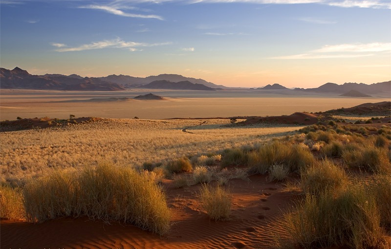
Dosya:NamibDesert01.jpg
NamibDesert01.jpg ((800 × 510 piksel, dosya boyutu: 118 KB, MIME tipi: image/jpeg))
Dosya geçmişi
Dosyanın herhangi bir zamandaki hâli için ilgili tarih/saat kısmına tıklayın.
| Tarih/Saat | Küçük resim | Boyutlar | Kullanıcı | Yorum | |
|---|---|---|---|---|---|
| güncel | 04.00, 16 Temmuz 2008 |  | 800 × 510 (118 KB) | Jarekt | {{Information |Description=Removed watermark |Source= |Date= |Author= |Permission= |other_versions= }} |
| 15.35, 12 Şubat 2007 |  | 800 × 533 (140 KB) | Frokor | {{Information |Description=Sunset at Namib Rand Nature Reserve - NAMIBIA |Source=http://en.wiki.x.io/wiki/Image:NamibDesert01.jpg |Date=16 July 2005 |Author=Marco Woschitz http://www.woschitz.net |Permission= |other_versions= }} [[Category:Namib Dese |
Dosya kullanımı
Bu görüntü dosyasına bağlantısı olan sayfalar:
Küresel dosya kullanımı
Aşağıdaki diğer vikiler bu dosyayı kullanır:
- als.wiki.x.io üzerinde kullanımı
- ar.wiki.x.io üzerinde kullanımı
- azb.wiki.x.io üzerinde kullanımı
- be-tarask.wiki.x.io üzerinde kullanımı
- be.wiki.x.io üzerinde kullanımı
- bn.wikivoyage.org üzerinde kullanımı
- ckb.wiki.x.io üzerinde kullanımı
- de.wiki.x.io üzerinde kullanımı
- el.wikivoyage.org üzerinde kullanımı
- en.wiki.x.io üzerinde kullanımı
- en.wikivoyage.org üzerinde kullanımı
- eo.wiki.x.io üzerinde kullanımı
- et.wiki.x.io üzerinde kullanımı
- fa.wiki.x.io üzerinde kullanımı
- fa.wikivoyage.org üzerinde kullanımı
- ff.wiki.x.io üzerinde kullanımı
- fr.wiki.x.io üzerinde kullanımı
- ha.wiki.x.io üzerinde kullanımı
- hr.wiki.x.io üzerinde kullanımı
- hu.wiki.x.io üzerinde kullanımı
- hy.wiki.x.io üzerinde kullanımı
- hyw.wiki.x.io üzerinde kullanımı
- id.wikivoyage.org üzerinde kullanımı
- incubator.wikimedia.org üzerinde kullanımı
- is.wiki.x.io üzerinde kullanımı
- kk.wiki.x.io üzerinde kullanımı
- nn.wiki.x.io üzerinde kullanımı
- ru.wiki.x.io üzerinde kullanımı
- sah.wiki.x.io üzerinde kullanımı
- sh.wiki.x.io üzerinde kullanımı
- sl.wiki.x.io üzerinde kullanımı
- sn.wiki.x.io üzerinde kullanımı
- sr.wiki.x.io üzerinde kullanımı
- sw.wiki.x.io üzerinde kullanımı
- uk.wiki.x.io üzerinde kullanımı
- ur.wiki.x.io üzerinde kullanımı
- zh.wiki.x.io üzerinde kullanımı

